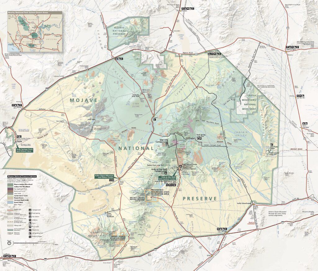
Mojave National Preserve: Barber Peak Loop Trail
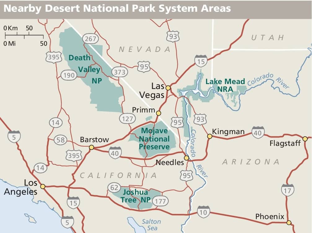
The Barber Peak Loop Trail in Mojave National Preserve is a hike we come back to again and again in the winter when we’re tired of being sedentary and need some sunshine, fresh air, and solitude. We often include it on trips to Las Vegas, spending a few days exploring the many outdoor activities within a couple of hours’ drive of the city.
This National Park Service site has faced its share of challenges in recent years, including floods and fires. Even so, the trailhead for this hike has consistently remained accessible, and the trail has always been open when we visit. All that said, it’s still a good idea to check the park’s website for current conditions before going.
The Rings Loop Trail is popular, but…
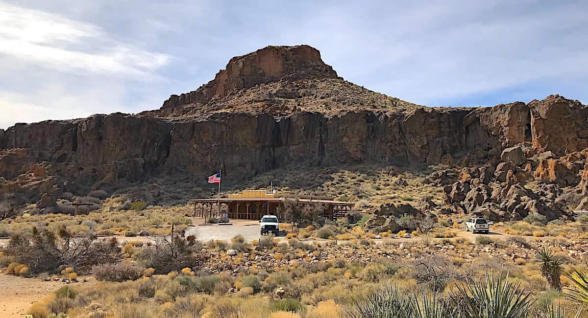
Many hikers come to this area specifically to hike the Rings Loop Trail, typically clockwise from the Hole-in-the-Wall Information Center. That route includes a fun scramble through Banshee Canyon, where metal rings permanently attached to the canyon walls make the steep sections manageable. Without them, most hikers wouldn’t be able to climb up through the slot.
We love hiking the rings, but we save that scramble for the end of the day. Instead of doing the standard Rings Loop, we hike the Barber Peak Loop counterclockwise from the information center. The loop is a moderately difficult six-mile hike that usually takes us three to four hours to complete.
The loop circles Barber Peak and passes through desert washes, volcanic slopes, and open plains before returning through canyon terrain. We’ve hiked this trail five or six times, and on several visits we’ve seen cattle or horses near the trail. Once a cow walked in front of us, right on the trail, for about a half mile. I guess it never crossed his mind that he could step aside and let us pass.

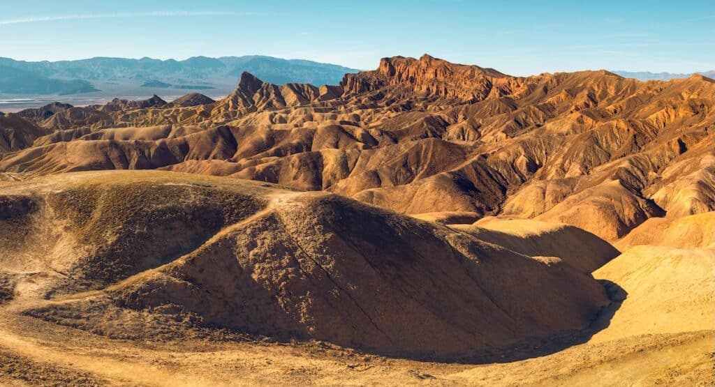
On the back side of the loop, about a mile from Banshee Canyon, you’ll pass through an area that looks almost landscaped. Known as the Cactus Garden, this section winds through red and black volcanic rock and features some of the most impressive California barrel cactus we’ve ever seen.
Now we head over to the rings
Toward the end of the loop, we take a cutoff trail over to Banshee Canyon and climb up through the slot using the rings. It looks more intimidating than it actually is and makes for a fun challenge at the end of a satisfying desert hike. From there, the hike back to the information center is a short walk on a paved road.
Crowds here are uncommon, yet we’re always a little surprised to encounter a few other hikers each time we visit.
If high temperatures are in the forecast, plan to start your hike as early as possible. There is virtually no shade anywhere along the trail.
Check road conditions before you go
Park roads in the preserve are aging and have sustained damage from flooding over the years. The park website notes: “Many of the paved roads in the preserve were constructed decades ago and are showing their wear with narrow shoulders, drop-offs, and recurring potholes. Use at your own risk. Drive carefully.”
While we haven’t personally encountered impassable paved roads, it’s always wise to visit the park’s website before going to check roads conditions. There’s another reason to drive slowly here as well: desert tortoises live in the preserve and can be difficult to spot as they slowly cross the road. Please watch for them and give them space.
Trail facts
- Distance: about 6 miles
- Elevation gain: about 700 to 1,000 fee
- Difficulty: moderate
- Trail type: loop
- Typical time required: about 3 to 4 hours
- Best season: fall through spring
- Crowd level: low
Good to know
- The trailhead is located at the Hole-in-the-Wall Picnic Area near the information center and campground. We always park at the information center, then hike the social trails to the campground. At the north end of the campground, you’ll see a trailhead sign.
- There is no shade along the route, so carry more water than you think you will need.
- Trail markers can be difficult to spot in wash crossings; having a GPS map device is helpful.
- Standard desert hazards include heat exposure and cactus spines along narrow sections of the trail.
- There are no gas or charging stations in the preserve. We always fill up before we enter the park to be sure we don’t run out.
Nearby or related
- If you like sand dunes, the Kelso Dunes are a little over an hours’ drive away and are also in the preserve. It’s a challenge hiking to the top of the dunes, but the territorial views when you get there are worth it.