Death Valley National Park: Gower Gulch and Golden Canyon Loop
The Gower Gulch–Golden Canyon Loop in Death Valley National Park is one of our favorite desert hikes. It’s physically challenging but doable if you take your time. The scenery is stark and stunning. And despite its popularity, you can still find a surprising amount of solitude.
And it’s easy to get to
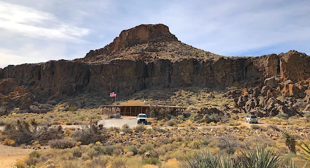
Unlike many hikes in the park, the trailhead isn’t a long drive if you’re staying near Furnace Creek. From the visitor center, it’s about a 10-minute drive to the parking area. Arrive early if you want a spot. Otherwise, you might end up hounding the other hikers until one of them gives up their space.
Popular and solitude?
Here’s the trick (we learned it from a ranger): hike the loop counterclockwise. Most people head straight up Golden Canyon first. It’s the marquee attraction and a beautiful trail, but many hikers turn around and go back the same way instead of completing the loop. As a result, roughly two-thirds of the trail is much less crowded.
If you start by heading south toward Gower Gulch instead, you’ll see fewer people until you reconnect with Golden Canyon during the final third of the hike. We’ve done the loop both ways, and we also think the views are better going counterclockwise.
Four landscapes, one trail
One reason we like this trail so much, beyond how easy it is to reach, is the variety packed into a relatively short distance, about 4.3 miles.
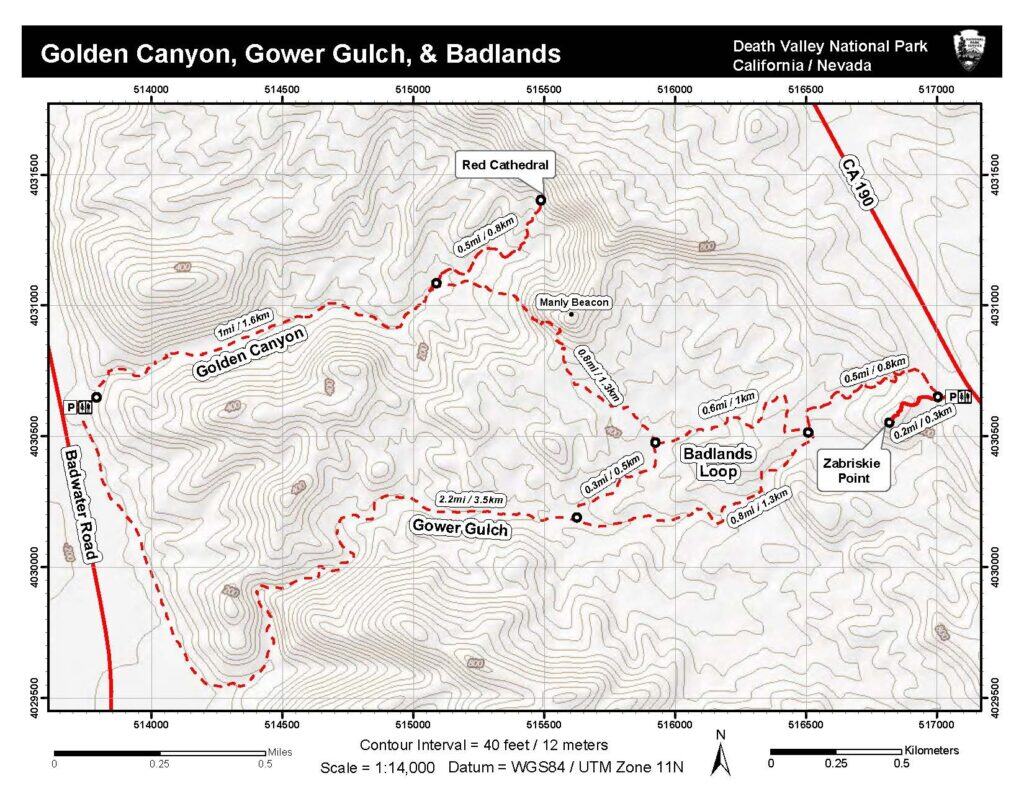
The hike begins across open desert for roughly half a mile. You’ll walk parallel to Badwater Road until the trail turns east and leads into Gower Gulch, a wide wash with several pour-overs and narrow choke points that are easy to climb.
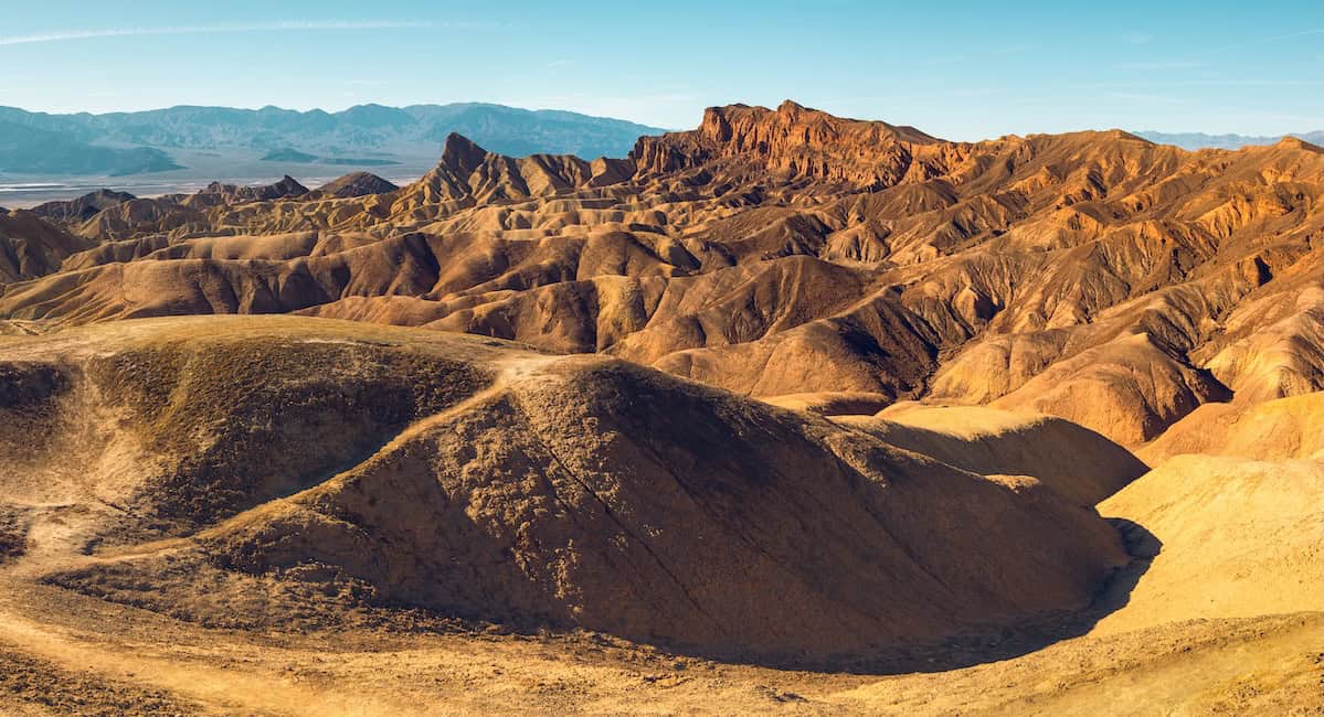
Have you ever hiked on the moon?
About 2.2 miles into the hike, watch for trail markers pointing north toward the Badlands Loop and Golden Canyon. Here, the landscape turns to moonscape as the trail passes over roly-poly yellow mudstone cliffs. There’s enough elevation gain to remind you you’re getting a good workout, and when you stop to catch your breath, take a moment to enjoy the wide views across the valley to the Panamint Range.
Staying on this route eventually brings you to the junction with Golden Canyon. The final stretch feels completely different from what came before. You’re now walking through a deep canyon with a wide, flat, sandy trail that leads you back to the parking area.
If any of these directions seem unclear, take a look at the trail map that accompanies this post. Once you see it laid out, it’s pretty straightforward.
Want more?
If you have the time and energy and want to explore a bit more, there are several worthwhile variations. Near the end of Golden Canyon, about a mile from the trailhead, a spur trail leads to Red Cathedral. This additional stretch of trail is a more challenging slot canyon hike than Golden Canyon ending at Red Cathedral, a fire-colored natural amphitheater.
There are also a couple of variations on the backside of the loop that connect to Zabriskie Point. We’ve hiked one of these before and enjoyed the bonus mileage, but it does make for a long day by the time you get back to the Golden Canyon trailhead.
Trail Facts
- Note: The stats below is for the Gower Gulch and Golden Canyon Loop. See the Gower Gulch NPS webpage for info about the variations.
- Distance: 4.3 miles total
- Elevation gain: 850 feet
- Difficulty: Moderate
- Trail type: Loop
- Typical time required: 2 to 3 hours
- Best season: November through March
- Crowd level: Heavy in Golden Canyon; moderate in Gower Gulch
Good to Know
- Parking: The main lot at Golden Canyon fills early during winter weekends.
- Hazards: Flash floods pose a risk during rare rain events.
- Water: No water exists on the trail so carry plenty for everyone in your group.
- Sun: Most of the route is exposed with a little shade in the canyons.
Nearby or Related
- Zabriskie Point: As mentioned in the description above, you can extend this hike to reach the famous overlook for a higher vantage point.
- Badwater Basin: After your hike, visit this nearby salt flat to see the lowest point in North America. Some years, not all, when rains are heavy, a portion of Badwater Basin becomes a lake, Lake Manly.
Other Resources
- Official Map: Consult the National Park Service Death Valley hiking guide for more hiking options in the park.
Audio Clip
Below is an excerpt from our podcast where we briefly discuss hiking this loop.