White Sands National Park: Alkali Flat Trail
I’m not usually a fan of climbing sand dunes. Kelso Dunes in the Mojave, Sleeping Bear Dunes in Michigan, and the Great Sand Dunes of Colorado have all taken me to my knees. Literally. But hiking the dunes at White Sands National Park is different. It’s the rare exception. In fact, the Alkali Flat Trail within the park has become one of my favorite hikes in the entire National Park System.
They’re not like other dunes we’ve experienced.
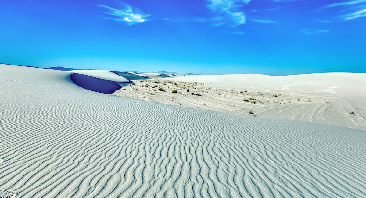
Let’s start with the obvious: the sand is white, as white as snow. Made up primarily of gypsum, White Sands is the largest area of gypsum sand in the world. Being white doesn’t make the sand easier to hike through, but they are stunning to look at, especially against a brilliant blue New Mexico sky.
Another difference is scale. Despite the dunefield’s massive size, about 275 square miles, with roughly 115 of those inside the national park, the tallest dunes are only about 60 feet. That may not sound very high but climb to the top of a steep 60-footer and you’ll agree it’s more than tall enough.
The trail is well marked
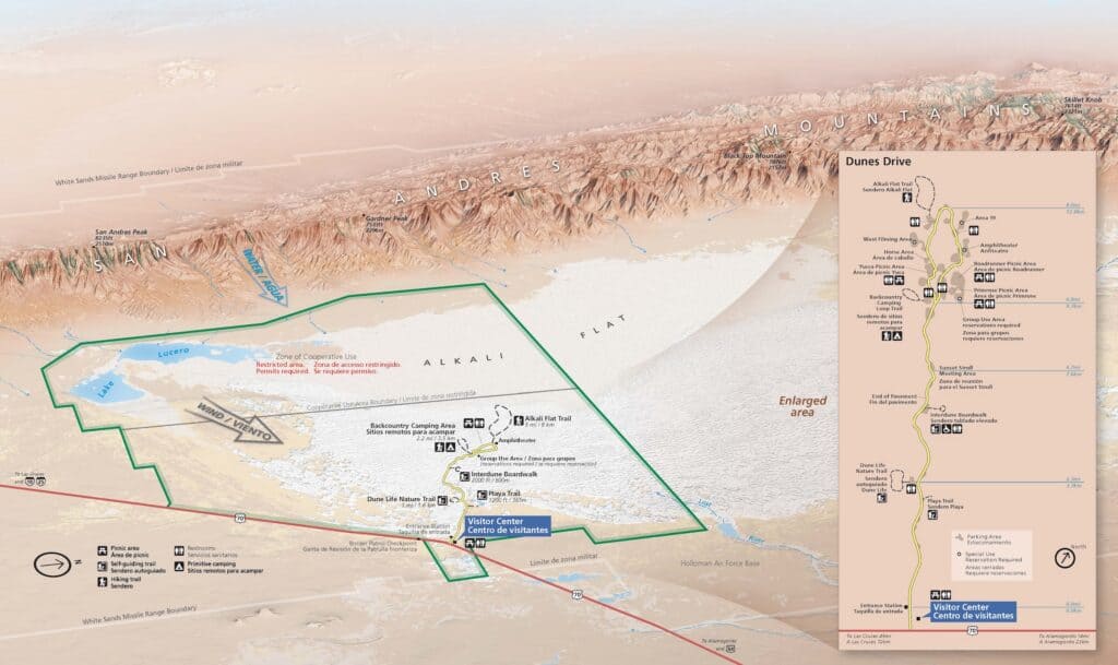
Unlike other large piles of sand we’ve been to, White Sands is low and wide, which makes it possible for the park to stake out a trail you can actually follow. To keep hikers from getting hopelessly lost, they’ve placed trail markers along the entire route of the Alkali Flat Trail.
These bright red markers are far enough apart to not be intrusive but close enough that you can always see the next one. This lets you concentrate on navigating the ups and downs and enjoying the views without worrying about getting lost.
The trail is a loop, and at the far end hikers come to the border of Alkali Flat that’s within the White Sands Missile Range. A sign lets you know when you’ve gotten too close and should turn back toward the next red marker. Good advice. It’s a military missile range, not a place you want to explore on foot, unauthorized.
So many reasons to love this trail
Yes, there’s something enjoyable about this wide-open five-mile trail that keeps us coming back. It’s beautiful. The hike is physically challenging but within reason so long as the temperatures are mild and you have enough water with you. Crowds are rarely a problem. And you feel totally immersed in a unique landscape unlike any other you’ve experienced.
Trail Facts
- Distance: 5 miles
- Elevation gain: Constant climbing over 60-foot dunes
- Difficulty: Strenuous
- Trail type: Loop
- Typical time required: 2.5 to 5 hours
- Best season: Fall, winter, and spring
- Crowd level: Moderate; most visitors stay near the parking lot
Good to Know
- Set expectations: There is no shade, water, or toilet facility along the trail.
- Parking notes: The trailhead is at the very end of Dunes Drive, roughly 7 miles from the visitor center.
- Hazards: Extreme heat is a major risk; rangers recommend not hiking if temperatures exceed 85 degrees. Read the park’s safety tips webpage before hiking this trail.
- Special instructions: The park recommends that you carry at least one gallon of water per person. Wear sunglasses to protect your eyes from the intense glare reflecting off the bright sand.
Nearby or Related
- Dune Life Nature Trail: A shorter one-mile loop that provides more information on the desert ecosystem.
- Interdune Boardwalk: An accessible 0.4-mile path for those who want views without walking in deep sand.
Other Resources
- Sunset Stroll: A ranger led program often held in the evenings to learn about the dunes.